Crossing the Sahara: a route map


A visual investigation made for Gallerie delle Prigioni’s debut art exhibition, Sahara: What is written will remain, dedicates to the cultural heritage of the desert.
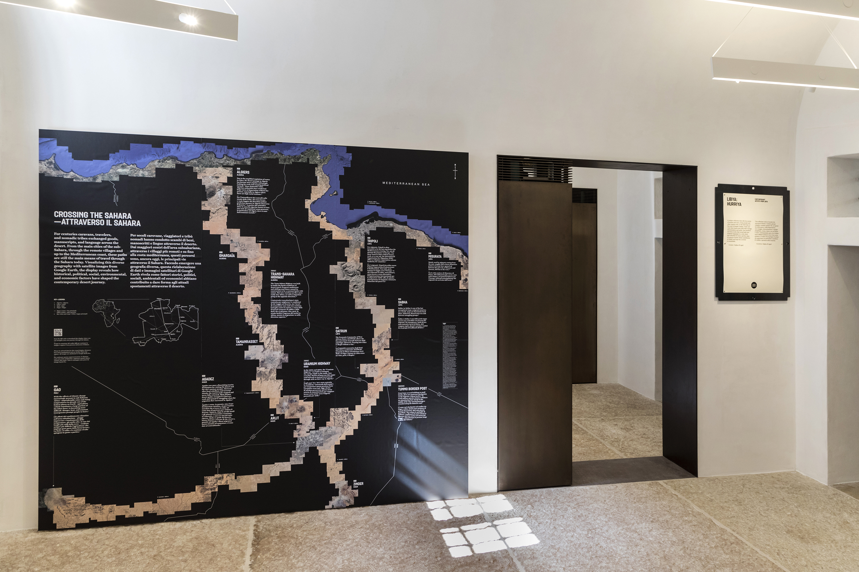
With the concern that the idea of Sahara might sound too remote for most of the exhibition visitors, an extensive study about today’s cross-Sahara travelling was undertook, in search of perspectives which could make the subject relevant to our living experiences. The result is this routes map placed right in the first room of the exhibition space.
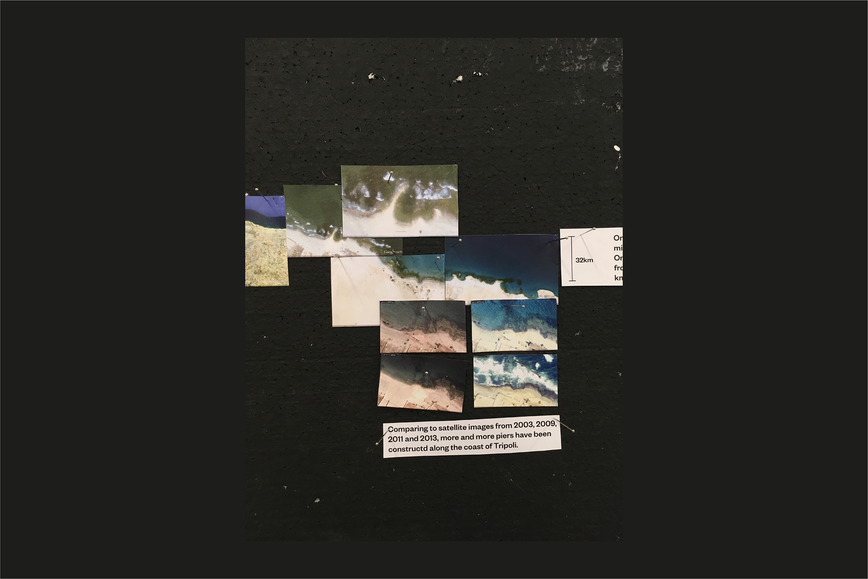
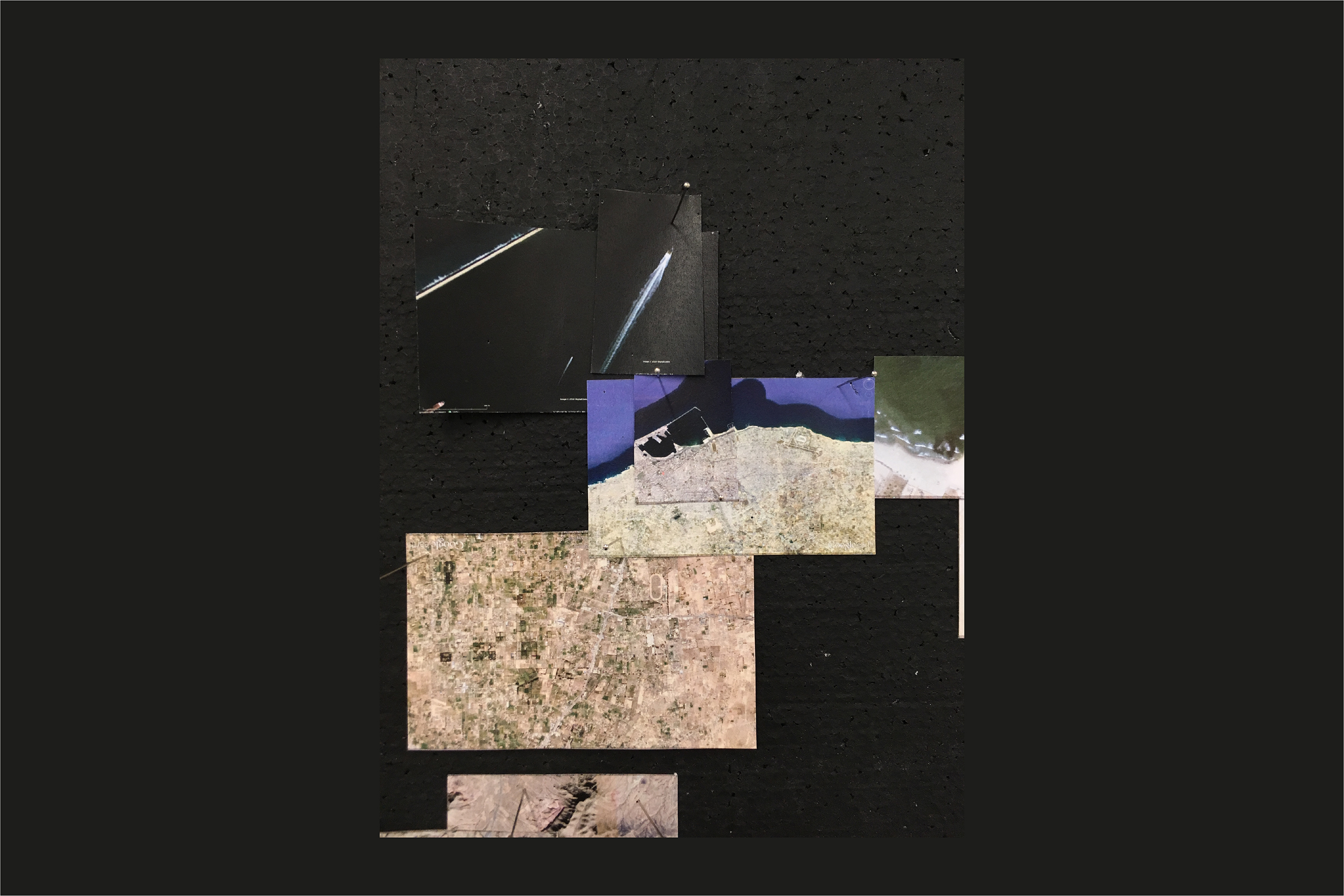
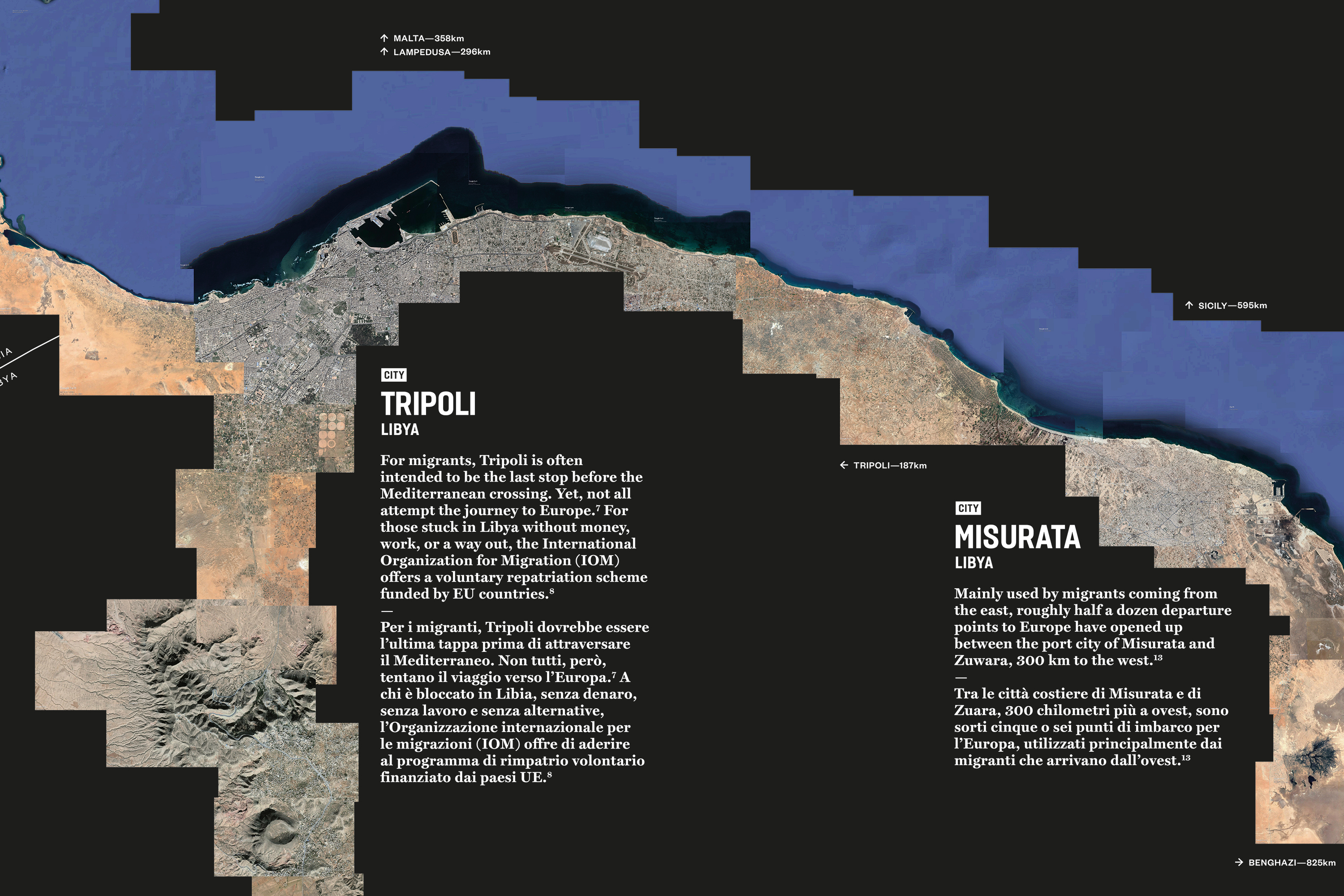
From the information gathered from news articles and reports, a few commonly-used paths by the desert frequent travellers—African refugees, human traffickers, environmental migrants, international tourists and truck drives who work in uranium and oil fields—are reconstructed by around 400 satellite images from Google Earth.
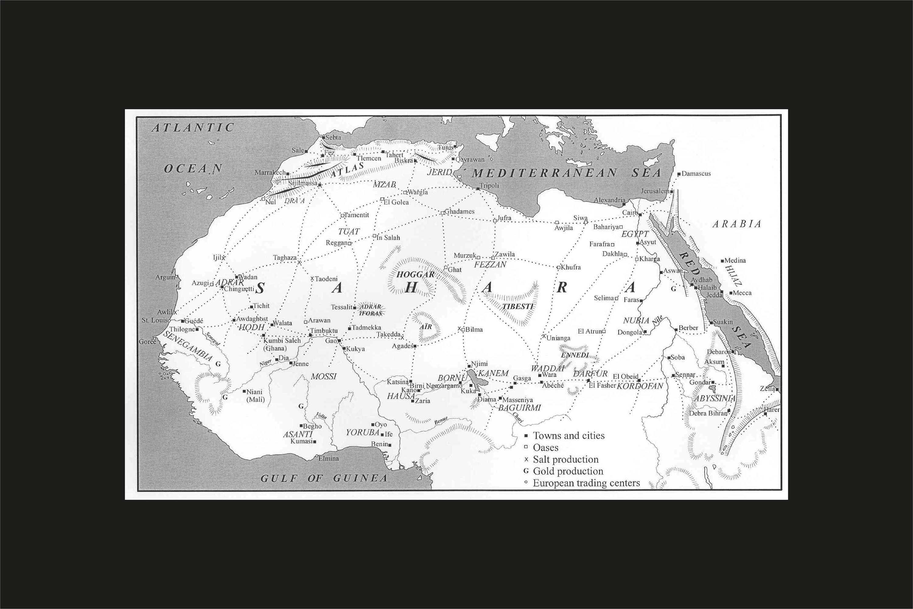
As the curator wrote on this infographics: Crossing the Sahara Desert is an age-old phenomenon, for centuries, the trans-Saharan trade routes linked the Mediterranean and sub-Saharan Africa, where caravans, travellers, and nomadic tribes exchanged goods, manuscripts, and language across the desert. From the main cities of Gao and Agadez, through the remote villages of Ghardaïa and Qatrun, up to Tripoli and Algiers along the Mediterranean, these paths are still the main means of travel through the Sahara today. Visualizing the diverse geography with satellite images from Google Earth, this display reveals how historical, political, social, environmental, and economic factors have shaped the contemporary desert journey.
You can also check out the google map version here.
English writing and editing bySuzanna Petot;
Italian translation by Chiara Longhi and Giorgia de Luca;
Photos by Marco Pavan.
With the concern that the idea of Sahara might sound too remote for most of the exhibition visitors, an extensive study about today’s cross-Sahara travelling was undertook, in search of perspectives which could make the subject relevant to our living experiences. The result is this routes map placed right in the first room of the exhibition space.
From the information gathered from news articles and reports, a few commonly-used paths by the desert frequent travellers—African refugees, human traffickers, environmental migrants, international tourists and truck drives who work in uranium and oil fields—are reconstructed by around 400 satellite images from Google Earth.
As the curator wrote on this infographics: Crossing the Sahara Desert is an age-old phenomenon, for centuries, the trans-Saharan trade routes linked the Mediterranean and sub-Saharan Africa, where caravans, travellers, and nomadic tribes exchanged goods, manuscripts, and language across the desert. From the main cities of Gao and Agadez, through the remote villages of Ghardaïa and Qatrun, up to Tripoli and Algiers along the Mediterranean, these paths are still the main means of travel through the Sahara today. Visualizing the diverse geography with satellite images from Google Earth, this display reveals how historical, political, social, environmental, and economic factors have shaped the contemporary desert journey.
You can also check out the google map version here.
English writing and editing bySuzanna Petot;
Italian translation by Chiara Longhi and Giorgia de Luca;
Photos by Marco Pavan.